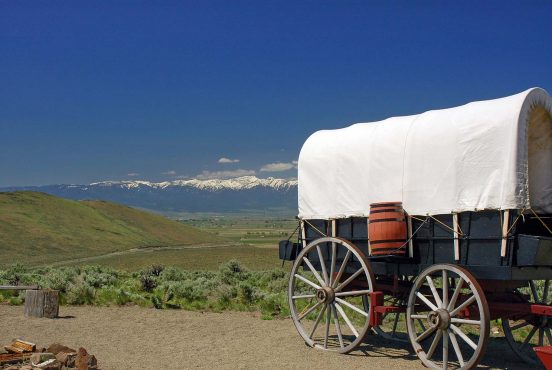
To paraphrase John Muir, “the Wasatch Mountains are calling, and I must go.”
Sitting at the doorstep of the Uinta-Wasatch-Cache National Forest, there’s no shortage of breathtaking hikes and viewpoints around here. You’ll find a number of great trails that start in the city limits, and even more astounding scenery as you leave the city behind and explore further into the canyons.
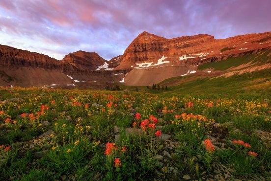
Of course, the Wasatch Range delivers far more than just lofty peaks and canyon views. The mountains are teeming with wildlife, and the soothing sounds of flowing water are ever present thanks to an abundance of lakes, streams, and waterfalls. Time your trip right and you’ll find meadows of wildflowers over summer and golden aspen galore when autumn arrives.
When you’re in Salt Lake City and you hear the call of the wild, we’ve got you covered.
Here are 17 of the best local hikes to get out and reconnect with nature, featuring all of the must-see crowd favorites and a handful of under-the-radar picks for locals in search of something new. And if you’re looking for an extended trip, check out some of our favorite campervan rentals in Salt Lake City.
Related Read: 12 Spectacular Day Trips from Salt Lake City
Lake Blanche
View this post on Instagram
Why you should go: a steep climb to three gorgeous mountain lakes.
- Distance: 7 miles
- Elevation Gain: 2,600 feet
- Difficulty: Moderate
The Lake Blanche trail ascends about 750 feet per mile, so you’ll be feeling this one in your legs and lungs by the time you reach the finale. It’s absolutely worth the challenge, though, rewarding hikers with the chance to visit three beautiful mountain lakes.
You’ll be in the trees for most of this hike, so it’s a great choice for hot summer days. When the canopy opens up from time to time, you’ll also enjoy views of Raymond and Gobbler’s Knob to the north.
Once you’ve had your fill of Lake Lillian, Lake Florence, and Lake Blanche, consider pressing on to Sundial Peak for more epic mountain views.
More Information: Hiking Project
Donut Falls
View this post on Instagram
Why you should go: an easy hike to a truly unique waterfall.
- Distance: 3 miles
- Elevation Gain: 530 feet
- Difficulty: Easy
There are countless waterfalls to see in Utah, but there’s only one that drops into a cave — Donut Falls. Centuries of water erosion carved a donut-shaped hole into the ceiling of the small cave, allowing the waterfall to shower through the rocky roof into the pool below. The result is a magical scene that you rarely encounter on waterfall hikes, especially family-friendly trails like this.
The best time to visit Donut Falls is over summer when the water flow is at its peak and wildflowers are blooming, though the icy waterfall is a remarkable sight during the winter.
More Information: Utah Travel
The Living Room
View this post on Instagram
Why you should go: a local favorite with fetching valley views.
- Distance: 2.5 miles
- Elevation Gain: 960 feet
- Difficulty: Moderate
No, we’re not talking about the long walk from the kitchen to your living room. There’s actually a trail called the Living Room in Salt Lake City, and it’s much cooler than it sounds.
The Living Room gets its name from the viewpoint at the top of the trail, where you’ll find a collection of rocky seats that resemble couches in a living room. They’re not exactly the most comfortable couches, but the views from this Living Room definitely beat the view from your couch at home.
The Living Room is a popular meeting place for friends and coworkers after work, so you’ll almost always find a crowd here. Bring a couple of granola bars to share and you may wind up with a few new friends.
More Information: Visit Utah
Mount Olympus
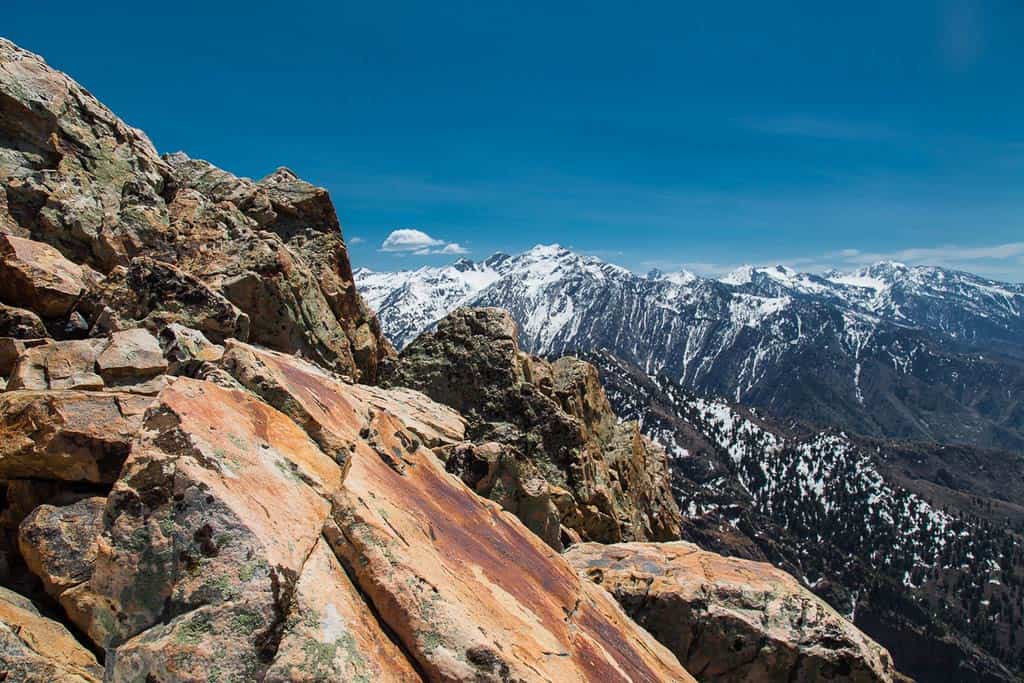
Why you should go: summit one of the most prominent peaks in the Wasatch Range.
- Distance: 6.6 miles
- Elevation Gain: 4,190 feet
- Difficulty: Hard
Mount Olympus may not be the tallest mountain in the Wasatch Range, but it certainly stands out in the Salt Lake City skyline. Bagging this summit comes with a lifetime of bragging rights — partly because the reference to Greek mythology is cool, but mostly because it’s a mighty tough trail to the top.
If you can survive the epic odyssey of climbing over 4,000 feet in a little over three miles, you’ll enjoy stunning panoramic views of the Salt Lake Valley and surrounding Wasatch mountains.
Don’t get caught up in the destination and forget to enjoy the journey, though. As the trail weaves through the valley and over the ridge lines before the final summit ascent, you’ll frequently find yourself in lush forest with the soothing sound of rushing water in the background.
Take your time, bring a picnic lunch, stop to smell appreciate the wildflowers, and you may find this trail isn’t as grueling as its reputation.
More Information: Visit Utah
Grandeur Peak
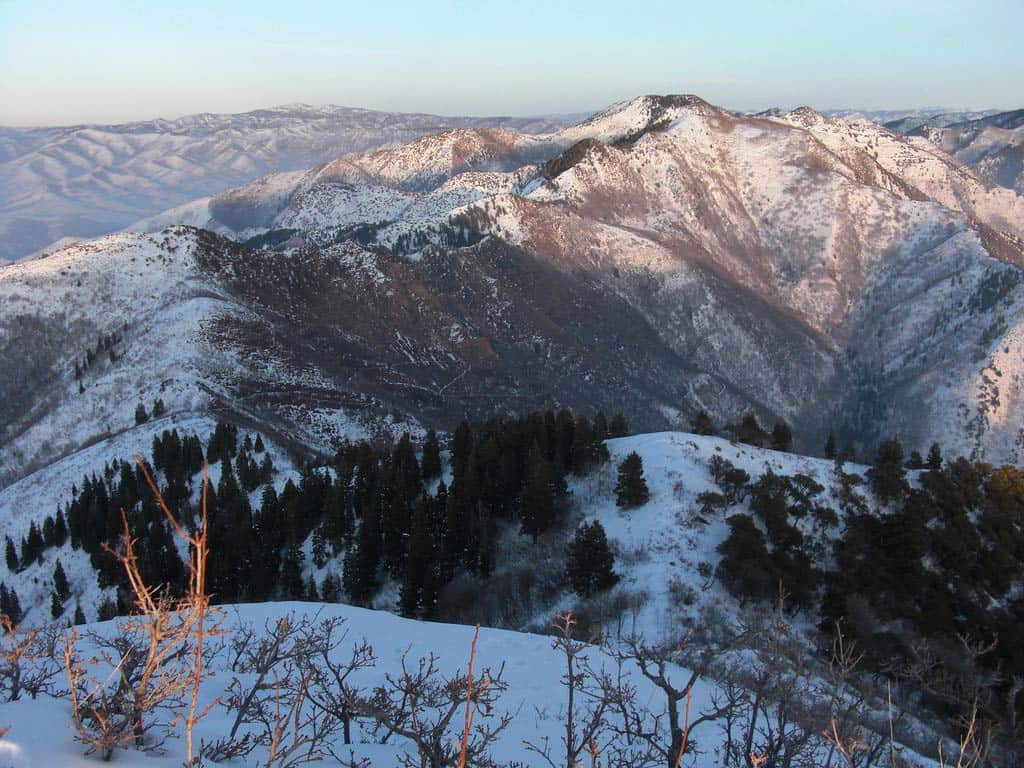
Why you should go: panoramic views of the Salt Lake Valley from 8,300 feet.
- Distance: 6 miles
- Elevation Gain: 2,400 feet
- Difficulty: Hard
If you’re itching to bag a summit but the rigorous climb to Mount Olympus is more than you’re ready to tackle, try hiking to Grandeur Peak. The trail is just as long with half the elevation gain, and the view from the top at 8,300 feet is equally magnificent.
There are actually two trails to Grandeur Peak. We’re talking about the more popular East Trail from Church Fork, a more mellow (but still challenging) hike that meanders up the mountain at a leisurely pace. Alternately, the West Trail blazes straight up the mountain for a faster but far more difficult climb.
More Information: The Outbound Collective
Ensign Peak
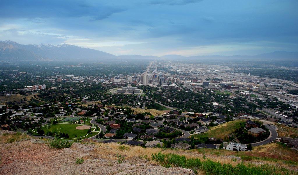
Why you should go: a classic Salt Lake City hike to a historic viewpoint overlooking the valley.
- Distance: 1.8 miles
- Elevation Gain: 380 feet
- Difficulty: Easy
Ensign Peak delivers a beautiful — and historic — view of Salt Lake City. Back in 1847 when the Mormon pioneers originally settled the area, this is where local leaders mapped out their plan to “make the desert bloom like a rose.”
It’s less than a mile to the scenic viewpoint and the elevation gain is pretty minimal, so bring the kids along to make it a family adventure.
There’s always a crowd at Ensign Peak thanks to its historical significance and the relatively easy hike, so it’s best to make this a sunrise or sunset hike if you’re looking for solitude.
More Information: Visit Utah
Willow Heights
View this post on Instagram
Why you should go: Willow Lake delivers an explosion of fall colors when the aspens turn to gold.
- Distance: 2 miles
- Elevation Gain: 500 feet
- Difficulty: Easy
When it comes to fall foliage, the Willow Heights Trail reigns supreme. The reflection of the golden aspens on the tranquil waters of Willow Lake never fails to impress, and you’ll often find a moose lurking in the willows nearby.
Bring the whole family along for this hike. The Willow Heights Trail is quick and easy, perfect for growing hikers that are ready to stretch their little legs.
More Information: The Outbound Collective
Brighton Lakes
View this post on Instagram
Why you should go: visit three alpine lakes and enjoy scenic vistas of Big Cottonwood Canyon.
- Distance: 3.5 miles
- Elevation Gain: 1,200 feet
- Difficulty: Moderate
Most Utah natives have hit the slopes at Brighton Resort during the winter, but you’re missing out if you don’t visit the resort over summer, too. Follow the Brighton Lakes Trail and you’ll find three picturesque mountain lakes — Lake Mary, Lake Martha, and Lake Catherine — along with countless connections to more backcountry trails and peaks.
When you’re finished exploring Brighton Lakes, head down the road to Silver Lake for a leisurely stroll around the waterfront before you leave the canyon. It’s less than a mile around the lake, and well-worth the detour.
More Information: The Outbound Collective
Desolation Overlook
View this post on Instagram
Why you should go: hike to a scenic viewpoint with stellar views of Millcreek Canyon.
- Distance: 4.4 miles
- Elevation Gain: 1,440 feet
- Difficulty: Moderate
A popular summer trail with ample shade under the pines, the Desolation Trail follows the ridgeline of Millcreek Canyon to a scenic overlook that peers through the canyon into the Salt Lake Valley.
Desolation Overlook can get a little crowded on weekends, but if you follow one of the quick side-trails you’ll find a more secluded view at one of the overlook’s rocky outcrops.
There’s a small fee to enter the canyon, but it’s worth it for the pleasant hike and beautiful views. Also, unlike the local watershed hikes that don’t allow furry friends, Millcreek Canyon and Desolation Trail are dog-friendly!
More Information: Visit Utah
Bells Canyon Waterfall
View this post on Instagram
Why you should go: a scenic stroll through the canyon to a cascading waterfall.
- Distance: 4.8 miles
- Elevation Gain: 1,460
- Difficulty: Moderate
The Lower Waterfall in Bells Canyon can’t compete with Stewart Falls, but it’s well worth an afternoon hike. The cascade slows to a trickle in the fall, so it’s best to plan your trip during the summer when the snow is melting and water flow is at its peak.
If you’re up for a more adventurous experience, bring your climbing gear and try rappelling down the granite cliffs around the waterfall. You can also continue hiking to the reservoir, though the trail is considerably more challenging past the waterfall.
More Information: Hiking Project
Red Pine Lake
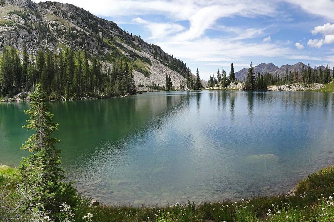
Why you should go: visit a pair of pristine mountain lakes in the Lone Peak Wilderness.
- Distance: 6.8 miles
- Elevation Gain: 1,940 feet
- Difficulty: Hard
Most people visit Red Pine Lake on an overnight backpacking trip, but it’s certainly doable as a day hike if you’ve got a healthy pair of legs. Either way, day trip or backpacking adventure, the challenging trail is immensely rewarding.
Highlighting the best features of the Lone Peak Wilderness, the Red Pine Lake trail serves up two high-mountain lakes for your viewing pleasure. The serene lakes are beautiful over summer, and they’re even more photogenic when autumn turns the leaves to gold.
Keep in mind that you’re in a watershed area, so there’s no swimming allowed in either of the lakes.
More Information: Visit Utah
Cecret Lake
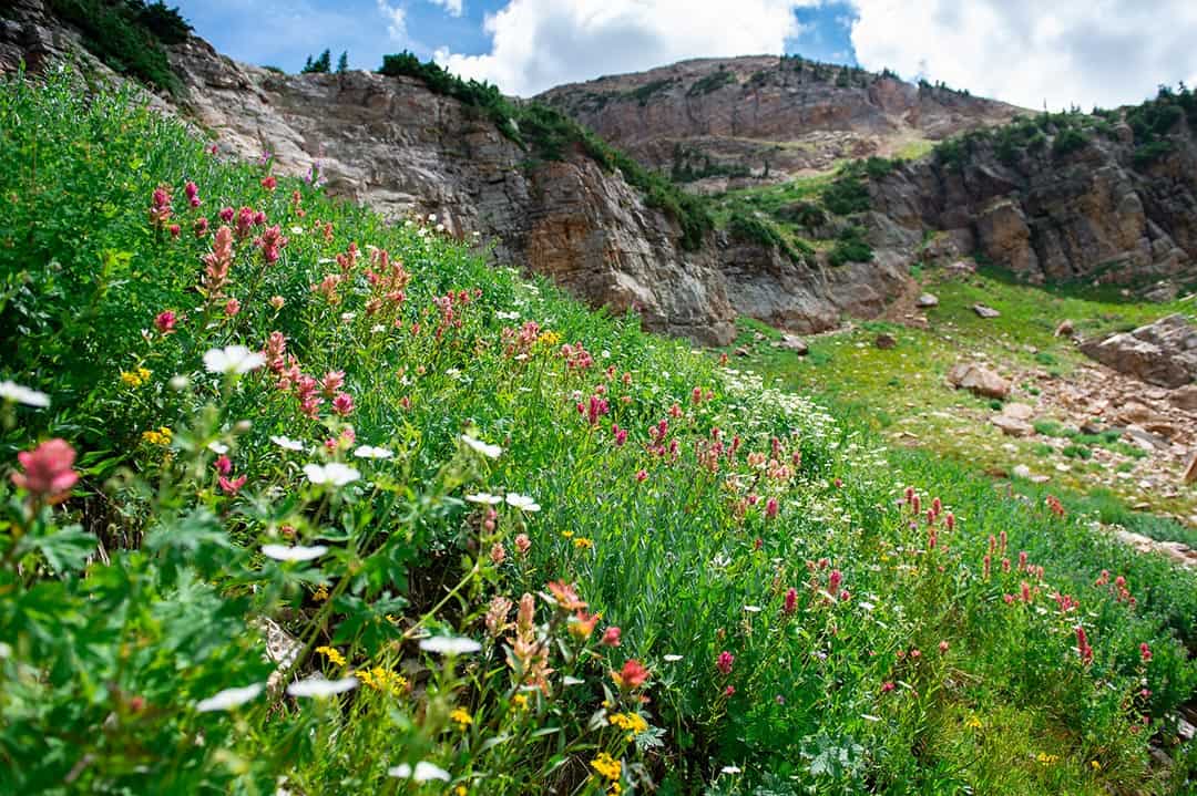
Why you should go: a family-friendly hike to a not-so-secret mountain lake.
- Distance: 1.7 miles
- Elevation Gain: 460 feet
- Difficulty: Easy
The trail to Cecret Lake begins at the Albion Basin Campground near the top of Little Cottonwood Canyon Road. It’s an easy trail with a gentle slope, and there are interpretive signs along the way to explain the local plants, animals, and geology.
If you’ve got enough time, stop at Cecret Lake for a picnic lunch and then continue onward to Sugarloaf Peak. Time your trip just right and you’ll discover a spectacular display of wildflowers and a gorgeous sunset from Sugarloaf.
More Information: Utah Travel
Rattlesnake Gulch
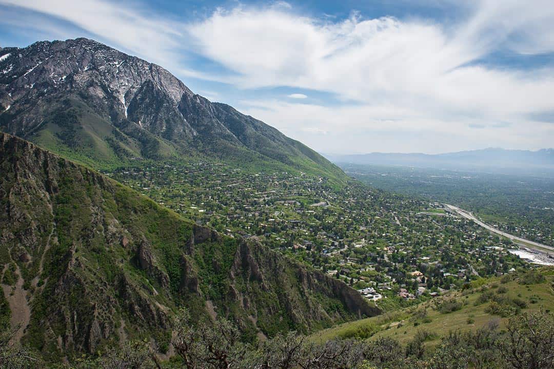
Why you should go: a great after-work hike or early morning trail run.
- Distance: 3.5 miles
- Elevation Gain: 700 feet
- Difficulty: Moderate
Rattlesnake Gulch Trail doesn’t have any jaw-dropping viewpoints, but it’s a great destination for trail runners and hikers who want to get away from the crowds. Dogs are always allowed on the trail, and you can even set your pup free on off-leash days. For the best experience, time your hike to hit the final viewpoint at sunset.
Heughs Canyon
View this post on Instagram
Why you should go: a great dog-friendly trail with valley views and a waterfall.
- Distance: 3.5 miles
- Elevation Gain: 1,940 feet
- Difficulty: Moderate
Heughs Canyon is another excellent trail for hikers and trail runners who want to ditch the crowds. It’s widely regarded as the best dog-friendly trail in the area, so don’t be surprised when you find a few furry friends along the trail.
On top of the valley views and rock formations that are par for the course around Salt Lake City, Heughs Canyon features a small waterfall where you can cool off on hot summer days. The waterfall slows to a trickle in the fall, so try to hit this trail early in the summer if you’re chasing waterfalls.
More Information: Outdoor Project
Neff’s Canyon
View this post on Instagram
Why you should go: a challenging hike that’s off the beaten path.
- Distance: 8 miles
- Elevation Gain: 3,600 feet
- Difficulty: Hard
The Neff’s Canyon trail will set your legs on fire with almost 1,000 feet in elevation gain per mile, but like most strenuous hikes it’s worth it for the killer views. Even better, you’ll get to appreciate the scenic canyon in solitude — unless you bring your dog, then you can happily share the view.
Wildflowers are abundant along the Neff’s Canyon trail, especially when you reach the meadow in the Mount Olympus Wilderness. That makes summer the best time to hit this trail, though the lack of fresh water along the trail means you’ll want to pack plenty of liquids to stay hydrated.
More Information: Girl on a Hike
Broads Fork Trail
View this post on Instagram
Why you should go: a secluded trail through mountain meadows overflowing with wildflowers.
- Distance: 5 miles
- Elevation Gain: 2,100 feet
- Difficulty: Hard
The Broads Fork Trail offers a wonderfully diverse mountain landscape, showcasing the best natural features of Big Cottonwood Canyon. The trail meanders through wildflower-filled meadows, thick pine forest, and magical aspen groves, all the while featuring scenic views of Twin Peaks and the surrounding high-mountain meadows.
Broads Fork Trail mostly flies under the radar and is challenging enough to ward off beginners, making it a great retreat for experienced hikers seeking solitude.
More Information: Utah Travel
Twin Peaks
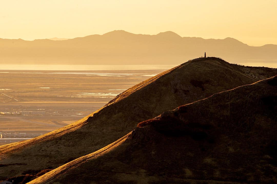
Why you should go: a quick family-friendly hike to a scenic viewpoint atop Twin Peaks.
- Distance: 3.2 miles
- Elevation Gain: 1,100 feet
- Difficulty: Moderate
If you live in downtown Salt Lake City, the quick trail from The Avenues to Twin Peaks should be on your list of go-to hikes. When you’re looking for a last-minute afternoon adventure, it’s a solid choice with great views that you can always share with your canine companion.
On your way to the top of Twin Peaks, you’ll enjoy scenic vistas of Little Black Mountain, City Creek Canyon, and of course the Twin Peaks themselves. The trail follows a portion of the Bonneville Shoreline Trail (aka the BST), so you can keep the adventure going if you’re looking for a longer hike.
More Information: Girl on a Hike
More Utah Hikes
For more tips on the best trails in Utah, check out our hiking guides for Provo, Moab, and Arches National Park. For multi-day hikes, see our article on the best backpacking trips in Utah that covers everything from overnighters to weeklong expeditions.
Explore Utah
Sign up for our free email to join thousands of readers getting epic travel, hiking, camping and gear ideas every week.

