With plenty of trails to choose from at Acadia National Park, there is one that stands above the rest.
When doing any sort of research for Acadia National Park hikes, one trail is guaranteed to make all the “best of” lists. The Beehive Trail is one of the shortest you can take in the park but also one of the most breathtaking. Known for its epic views and thrilling path, the Beehive Trail doesn’t disappoint.
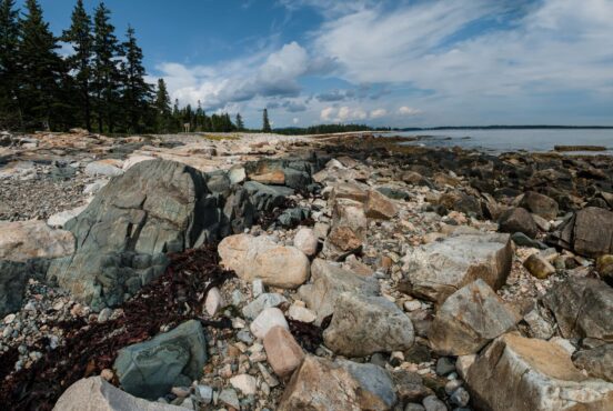
As a life-long New Englander, I’ve hiked the Beehive Trail many times. Despite the number of times I’ve repeated this path, the views from the southern face of the mountain never grow old. The asymmetrical hump can be seen from the road that loops around the park and, most notably, from the popular shores of Sand Beach.
Although looking at the Beehive from the ground is spectacular in and of itself, nothing compares to hiking it yourself. This trail report gives you all the tips and tricks you’ll need to make the most of your adventure on one of the best hikes in Maine.

Beehive Trail Fast Facts
- Roundtrip distance: 1.5
- Elevation gain: 500 feet
- Duration: 2-3 hours
- Difficulty: strenuous
- Nearest towns: Bar Harbor (7 miles), Bangor (50 miles)
- Day use fees: National Park fees ($20/person of $80/annual parks pass)
- Campground: Blackwoods Campground
Best for: hiking, stunning coastal views, thrill-seeking, mountain vistas
When to hike
The Park Loop Road is closed every year from December 1 until April 15. Not only is the Beehive Trail not accessible during winter months, it’s also extremely dangerous. The exposed granite slabs and iron rungs make the trail very slippery in any sort of rainy/snowy weather. This trail is best done from spring until fall.

Getting there
The Bowl Trailhead (the one that brings you up the Beehive) is found just north of the Sand Beach parking lot. You can park at the large parking lot at Sand Beach or park in a space along the road. The Park Loop Road is one-way for a large portion of it and every peak season, the right lane is closed so that visitors can park there. You can also leave the parking worries behind and take the free Island Explorer. This public resource keeps traffic down in the park and makes your life easier.
The Beehive Ascent
Most people park at the Sand Beach parking lot and walk the road back to the trailhead and that’s exactly what I did. Like many national parks across the United States, Acadia has seen an exponential increase in visitation. However, people still tend to sleep in and the trails and parking lots stay relatively empty if you are an early riser. So I got there around 6:30 am and there were only three other cars in the parking lot.
The trail starts off at a gentle incline through the typical boreal forest of Acadia. Only a quarter mile or so after the start of the trailhead, hikers will begin the steep climb up the Beehive’s southern face.
Fun fact: the Beehive’s iconic shape is due to a type of geologic formation called “glacial plucking”. It’s where glaciers move across already formed hills on the landscape creating a smooth and gradual ascent on one side. They then deposited large portions of rock on the other side forming steep, rocky cliffs. This is why it forms an asymmetrical shape when seen from afar.
Once I got turned onto the Beehive Trail from the Bowl Trail, the path immediately climbed up. This is where it is important to stick to the counterclockwise direction. If you go the other way, not only will you get tons of dirty looks but it will be highly dangerous and extremely inconvenient.

Keep Going
The trail ascends most of the elevation gain in this section. You switch from climbing up iron rungs to hugging the cliffside on narrow paths. Real talk: it’s not for everyone, especially those who get nervous with exposure. I used to be afraid of heights but have been on enough paths that I’ve sort of gotten over it. Still, this trail had me second guessing how “over it” I actually am.
With the huffing and puffing that comes with the ascent also comes the incredible vistas. The Atlantic Ocean can be seen to your right as you ascend and is spectacular no matter the weather. If it’s a typical, midcoast Maine foggy day, the eerie mist sways over the jagged cliffs and rugged coastline. On clear days, you can see for miles.
Navigating the narrow ledges is probably the hardest part of the trail. I wasn’t too concerned with the iron rungs since they are solidly bolted into the granite. The narrow ledges, however, give me the heebie jeebies. At certain spots there are only about two feet of trail – a mountain on one side and an adrenaline-inducing cliff on the other. I was thankful that not too many people were on the trail at this hour so that I could take my time moving forward.
At just about the half mile mark, you make it to the summit. Here you can see the same views you saw on the way up. The Atlantic Ocean sprawls out to the east of you and the rest of Acadia sits at your back to the west.

The Descent: The Easy Part
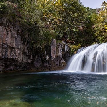
After the summit, you keep going along the trail and eventually hit a junction. You can either go left to head around the loop back to the trailhead or head straight down to The Bowl. I suggest heading straight to experience the serene waters and a spot that not too many people take the time to appreciate. You might get a glimpse of a loon or two or even some moose taking a break on the water’s edge. Afterward, continue on the trail and loop around the western side of the Beehive to make your way back to the trailhead.
From here on it, the trek back to the Beehive Trail was nothing compared to the iron rung climbs from the start. It meanders yet again through boreal forest and where critters run free throughout the pine needle covered ground.
The remainder of the descent was straightforward and easygoing, eventually leading me back to the Sand Beach parking lot. Including time spent at the summit and by the Bowl, the hike took me about two hours. You’ll have plenty of time to explore even more of this iconic park after you’re done.
Known Before You Go
Leave the Acrophobia Behind
It’s important to note that this trail is not for anyone who has a fear of heights (aka acrophobia). I cannot emphasize this enough. Even those who have the slightest fear have found the Beehive Trail to be too much. The entire hike up to the summit is via ferrata-esque where visitors are basically rock climbing the mountain’s southern face with the assistance of iron rungs.
Take the Weather Seriously
You should always check out the weather, no matter the trail you’re hiking. However, the Beehive Trail should be taken with more caution. Due to its use of iron rungs and exposed ridges, this trail becomes extremely dangerous the minute there is any sort of wet weather. Unfortunately, Maine isn’t known for its sunny, dry weather so the odds of you having to rethink your hike is high.
Hike Counterclockwise
The only way to do this loop trail is to hike it counterclockwise. I’m fairly certain that isn’t an official rule but it’s the safest and easiest way to hike the Beehive — and it’s trail etiquette. This results in hikers not having to wait for opposing hikers when the paths become too narrow or when climbing up the iron rungs.
Seen in: Acadia National Park, Hiking, National Parks