We research, evaluate and select travel destinations based on a number of factors, including our writers’ experience, user reviews and more. We may earn a commission when you book or purchase through our links. See our editorial policy to learn more.
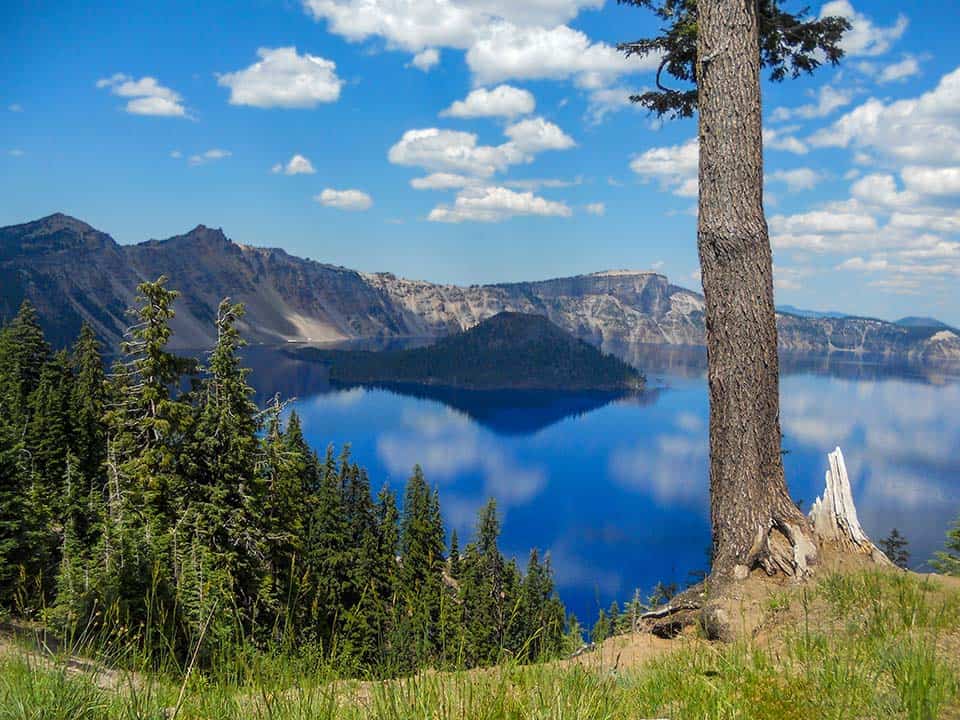
Crater Lake National Park is the only national park in the state of Oregon, and it is home to one of the most jaw-dropping natural wonders in all of America.
Crater Lake is a mythical place, a real place, described in poetry and legend. Where the lake water now resides once stood the gargantuan Mount Mazama, a mountain so large that it possibly dwarfed all others in the Cascade Range.
The one thing that first strikes you after the color, the blue, blue, even to blackness, with its belt of green clinging to the bastions of the wall, is the silence, the Sunday morning silence, that broods at all times over all things.”
-From Crater Lake by poet Joaquin Miller
Now, this National Park is a place that visitors from all over the world travel to see. It is home to many well-traveled paths that encircle and overlook the namesake lake, and it is home to backcountry trails and mountain summits that call to those who want to venture off the beaten path.
Don’t forget to grab a copy of the Crater Lake trails map before you head to the park!
Backpacking in Crater Lake National Park
The Pacific Crest Trail passes through the park, providing access to numerous long-distance backpacking routes. Backcountry camping permits are required for anyone spending a night in the woods, and they’re free.
We featured Crater Lake in our article on the Top 5 PCT Section Hikes in Oregon and Washington.
The Best Hikes in Crater Lake NP
Below you will find an exhaustive list of many of the most incredible hikes in Crater Lake National Park. There are several family-friendly and ADA-accessible routes located near Rim Village and Mazama Campground, and we’ve made sure to include some trails to sky-high peaks and hidden waterfalls for you adventurous types.
Castle Crest Trail
Why you should go: Turn your gaze downward toward a dazzling carpet of wildflowers.
- Difficulty: Easy
- Distance: 0.5 miles
- Elevation Gain: 120 feet
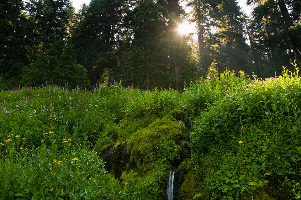
The average snowfall at Castle Crest tops out at several dozen feet, covering the high altitude slopes in deep snowpack through July. When the last of the sun cupped snowbanks melt away, the once dormant wildflowers bloom in a rainbow of colors amid the verdant mosses and grasses of the meadow.
This short and beautiful trek is adjacent to the visitor center. A detailed wildflower guide is available at the trailhead.
Additional Information: NPS.gov
Lady of the Woods
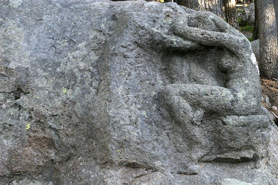
Why you should go: Discover a century-old sculpture within an old growth forest.
“This statue represents my offering to the forest, my interpretation of its awful stillness and repose, its beauty, fascination, and unseen life.” Said the Sculptor, Monroe, as reported by The Crater Lake Institute.
- Difficulty: Easy
- Distance: 0.7 miles
- Elevation Gain: 111 feet
Meander through the forest on this horseshoe-shaped trail to uncover an iconic ruin that stems from the national park’s humble beginnings. You’ll pass under tall timbers and past a babbling brook on your way to the ever-unfinished Lady of the Woods sculpture.
This relaxing journey begins and ends directly behind the visitor center. The sculpture was carved by a man named Monroe in 1917 in his time off from building the first rim drive around Crater Lake. He was deeply in love with the wilderness here.
Additional Information: Park Chasers
Sun Notch Trail
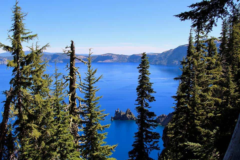
Why you should go: Nab some spectacular views of the infamous Phantom Ship.
- Difficulty: Easy
- Distance: 0.8 miles
- Elevation Gain: 127 feet
The Sun Notch Trail is a popular pullover spot on the East Rim Drive. This handicap-accessible trail is a well-groomed route over a field of wildflowers and under towering hemlocks, but this hike is all about the wonderful views at the rim.
An expansive vista opens up before you upon exiting the last copse of hemlocks. Towering rim walls rise high above the deep blue lake where the Phantom Ship resides. The small island is an eye-catcher, as is the imposing presence of Mount Thielsen lording over the far side of the lake.
Additional Information: Hiking Project
The Pinnacles
Why you should go: Step away from the lake to see some of the park’s other volcanic attractions.
- Difficulty: Easy
- Distance: 0.8 miles
- Elevation Gain: 40 feet
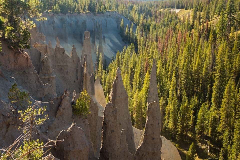
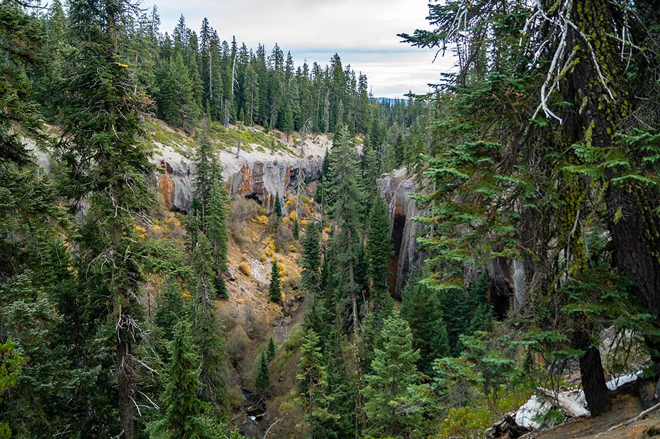
The Pinnacles trail is a short jaunt to the edge of a ravine that is home to large fumarole fossils. Rising above Wheeler Creek and Sand Creek are a number of interesting stone towers that formed as vents for hot steam and gas that vaporized when the waterways were covered in cooling volcanic material.
The trail leads from the road directly to the edge of the ravine, and there are spur trails that follow the rim and provide outstanding views from various perspectives.
Additional Information: Hiking Project
Godfrey Glen Loop
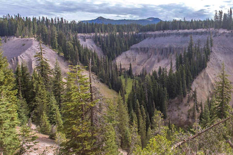
Why you should go: Walk on the upper rim of two canyons that are lined with columnar ash pinnacles.
- Difficulty: Easy
- Distance: 1.1 miles
- Elevation Gain: 65 feet
A fascinating and easy walk under hemlock and red cedar, the Godfrey Glen Loop offers a different perspective of Crater Lake National Park. The trail exists several thousand feet below the attraction-laden rim of Crater Lake.
This ADA-accessible path hugs the rims of Munson Creek Canyon and Annie Creek Canyon, providing overlooking views of the coursing waters that formed the ravines and the columnar ash formations that were created during Mount Mazama’s explosive lava flows.
Additional Information: Inspired Imperfection
Plaikni Falls Trail
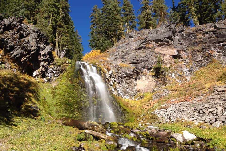
Why you should go: Make a quick side trip to see this stunning spring-derived waterfall.
“This family-friendly hike is a great option if you want to escape the crowds,” said Jennifer at Inspired Imperfection.
- Difficulty: Easy
- Distance: 2.0 miles
- Elevation Gain: 134 feet
Originating as snowmelt that has been filtered through layers of volcanic soil, Plaikni Falls’ crystal clear waters shimmer with prismatic brilliance. Plaikni is an indigenous Klamath word that means ‘from the high country’, referencing this beautiful stream’s genesis.
Wheelchairs and strollers will have no issue traversing the hard-packed trail to the falls. In addition to the waterfall, there are wildflowers, moss, and towering fir trees to see along this enhancing route.
Discovery Point Trail
Why you should go: See the sights you came for, and get a history lesson too.
- Difficulty: Moderate
- Distance: 1.3 miles
- Elevation Gain: 100 feet
Discovery Point is where gold prospectors first set their sights on the majesty of Crater Lake in 1853. The trail leaves from the park’s primary gathering grounds at Rim Village and follows Crater Lake’s rim adjacent to West Rim Drive.
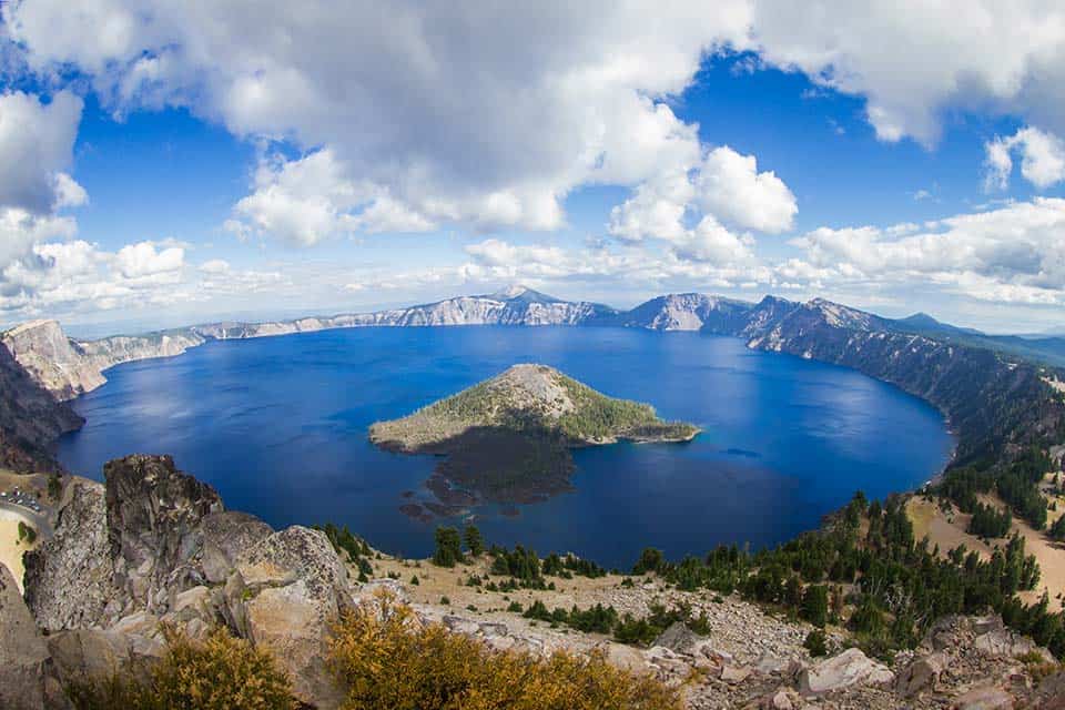
This is where some of Crater Lake’s best sights await to beheld. Several wide open viewpoints can be found along this short route with open vistas of the entire lake, including Wizard Island. This is a popular path where cute and hungry critters like gold-mantled ground squirrels and Clark’s nutcrackers will beg for snacks.
Additional Information: Crater Lake Institute
Watchman Peak
Why you should go: All-encompassing views from a fire lookout high above Crater Lake.
- Difficulty: Moderate
- Distance: 1.6 miles
- Elevation Gain: 387 feet
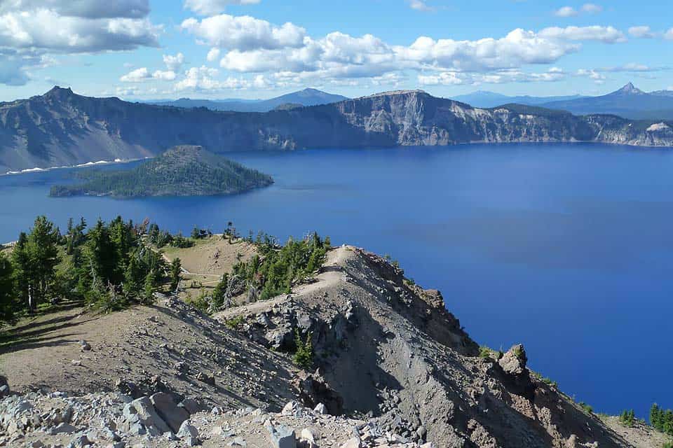
Watchman Peak offers arguably the best views and photo opportunities in Crater Lake National Park. The trail begins at a paved parking lot at a viewpoint called Watchman Overlook, and from there the path ascends sharply up a series of switchbacks to the fire lookout.
This is a popular trail, so expect to move slowly. The fire lookout at the summit serves as a mini-museum as an additional reward to those who reach the top of the climb. Night hikes to the peak can be scheduled with a ranger for an evening of unforgettable stargazing.
Additional Information: Hiking Project
Cleetwood Cove
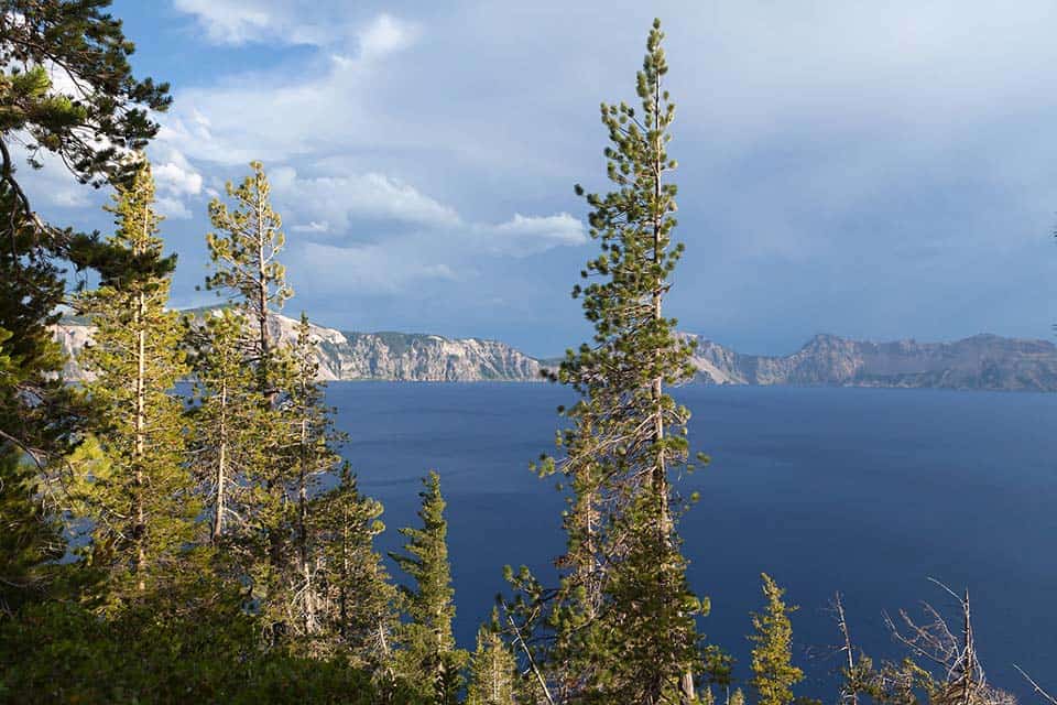
Why you should go: This is the only path down to the water of Crater Lake.
- Difficulty: Challenging
- Distance: 2.2 miles
- Elevation Gain: 640 feet
If you can only bear a single challenging trek during your time at Crater Lake, make it this series of switchbacks that descends down to the shore of Crater Lake at Cleetwood Cove. It is the only path to the water’s surface, and it is where swimming, fishing, and boat tours can be found.
Even if you do not want to take a boat ride, the experience of seeing the deep blue of Crater Lake from the shoreline perspective is alone worth the trek. The next two trails on our list are only accessible if you first take this trail down to the boat landing and hop aboard a skiff to Wizard Island.
Additional Information: Crater Lake Institute
Fumarole Bay
https://www.instagram.com/p/q60QAVKdHk/
Why you should go: You’ve taken the boat ride to Wizard Island and want to explore the shoreline.
- Difficulty: Moderate
- Distance: 1.7 miles
- Elevation Gain: 84 feet
Though far from an arduous trek, the journey to Fumarole Bay is over a rocky trail that can be tricky for those lacking fleetness in their feet. The hike will take visitors over to the southwest end of Wizard Island directly across from Watchman Peak.
A number of short spurs branch off from the main trail down to the shore, allowing for visitors to find momentary solitude at the center of the popular national park.
Additional Information: Crater Lake Institute
Wizard Summit
Why you should go: See a unique, panoramic view from up high in the center of the lake.
“We were surprised by the variety of colors of volcanic rock at the summit and the diversity of wildflowers!” said Amy Brahan at Just Go Travel Studios.
- Difficulty: Challenging
- Distance: 2.2 miles
- Elevation Gain: 305 feet
After an initial scurry over large chunks of volcanic rock, the trail to Wizard Summit is a well-defined route that climbs up the cinder cone through a thin forest that shortly gives way to soft and arid volcanic soil.
Once at the top, you will be standing on the edge of the Witches Cauldron, a volcanic crater that is 300 feet wide and 100 feet deep. The outstanding 360-degree views from this summit are seen by few who visit the park. There are footpaths that lead into the crater, but beware that the soil here is exceptionally loose.
Additional Information: Hiking Project
Annie Creek Canyon Trail
Why you should go: If you’re camping at Mazama Village this trail is right in your backyard.
- Difficulty: Moderate
- Distance: 1.7 miles
- Elevation Gain: 305 feet
Offering a magical journey across gorgeous landscapes along a burbling stream, Annie Creek Canyon Trail is a wondrous backcountry escape from the crowds that gather elsewhere in the park. This route lies behind Mazama Village, originating at Annie Spring.
The trail descends below forested slopes and towering ash formations, the likes of which can be seen from up high on the aforementioned Godfrey Glen Loop. You’ll walk past volcanic formations that have been carved by the creek over thousands of years.
Additional Information: American Southwest
Garfield Peak
Why you should go: It’s an accessible mountain hike offering amazing views.
- Difficulty: Challenging
- Distance: 3.6 miles
- Elevation Gain: 623 feet
The Garfield Peak hike begins at Crater Lake’s visitor hub of Rim Village. Though the moderate climb can be quite challenging for some, its proximity to the amenities at Rim Village make this a great option for those who want a challenge, but don’t want to head far from the comforts of civilization.
Hiking this trail early in the day or in the offseason may provide you with the opportunity to catch grazing deer, whistling marmots, and squeaking pika. This peak is covered in snow for most of the year, but snowshoes can be rented from Rim Village if you want to make it all the way to the top outside of summer.
Additional Information: Oregon Hikers
Mount Scott Trail
Why you should go: Scale the tallest peak in Crater Lake National Park.
- Difficulty: Challenging
- Distance: 4.4 miles
- Elevation Gain: 1,259 feet
A well-graded trail that starts off relatively flat and gradually steepens throughout the ascent, the Mount Scott Trail is a fair challenge that is exceptionally rewarding. There are numerous shaded respites along the trail that make for great break spots.
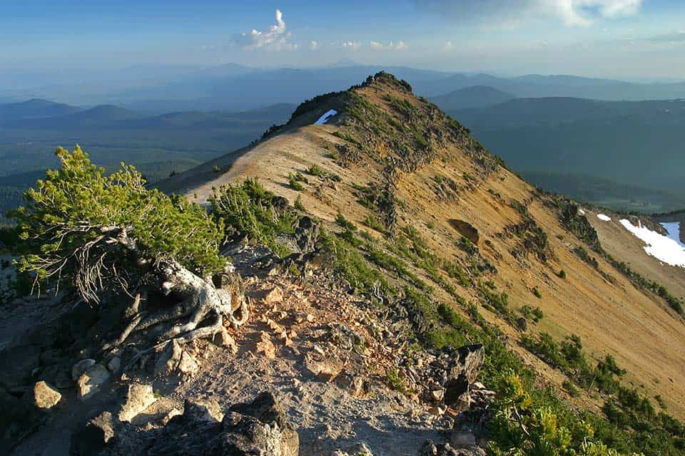
Once you surpass the switchbacks near the end of the trail, you’ll walk along a ridge to the fire lookout at the mountain’s peak. On a clear day, the panoramic views seem endless. You’ll have a full view of Crater Lake below, as well as the string of Cascades to the north and south and the desert to the east.
Additional Information: Hiking Project
Crater Peak Trail
Why you should go: It’s a classic, forested High Cascade trek serving up views of the Klamath Basin.
- Difficulty: Challenging
- Distance: 6.5 miles
- Elevation Gain: 1,184 feet
Reflecting what makes the Crater Peak Trail unique to the park, this route walks away from Crater Lake for its entire length. The object of fancy for this hike is not the park’s namesake body of water, but rather a view of the also impressive Klamath Basin and surrounding Cascade mountains.
The trail starts as a gentle walk through the forest, but, after about two miles of mild hiking, the climbing begins. Stone stairways and steep slopes are the challenges you’ll face during your final ascent to the peak.
Additional Information: Hiking Project
Union Peak
Why you should go: Seek solitude at this lonely peak that few care to visit.
“Union Peak is the core of what was an old volcano eroded by glaciers during the last Ice Age,” said Cassidy on Hiking Project.
- Difficulty: Challenging
- Distance: 9.8 miles
- Elevation Gain: 1,683 feet
In any other part of the Cascade Range, Union Peak would be a destination hike that residents of Eugene, Salem, Bend, and Portland would seek out, but here, in Crater Lake National Park, it is often overlooked because it offers no views of the lake itself.
Union Peak does, however, offer mesmerizing views of the Cascade Range, particularly to the south where Mount McLoughlin and, on a clear day, California’s Mount Shasta stand out with their snowy peaks. Few people take on this hike, but you may run into Pacific Crest Trail hikers during the first few miles.
Additional Information: Hiking Project
Bald Crater Loop
Why you should go: Search for wildlife amid the meadows, creeks, and lodgepole pine.
- Difficulty: Moderate
- Distance: 12.9 miles
- Elevation Gain: 1,178 feet
Bald Crater Loop serves several different purposes. Day hikers will often hike a part of this loop and return the way they came, though determined hikers can definitely complete the entire route in a day. There are two spur trails that follow different creeks which can be great places to pitch a tent for overnight backpackers.
One of those spur trails, the Boundary Springs Trail, connects to the Upper Rogue River Trail, opening up numerous pathways for long-distance backpackers to explore. The Bald Crater Loop is a beautiful route with an abundance of options for those looking to plan their own adventure.
Additional Information: Hiking Project
More PNW Adventures
Check out more of our of our hiking guides featuring the best places to hit the trail in the Pacific Northwest.
Sign up for our free email to join thousands of readers getting epic travel, hiking, camping and gear ideas every week.
Seen in: Crater Lake National Park, Destinations, Hikes, National Parks, Oregon

