If you’ve dreamed of hiking the Pacific Crest Trail but don’t have the time to commit to a few months away from your life, consider one of these five section hikes that can be completed in a weekend.
The Pacific Crest Trail (PCT) is a multi-use trail that stretches 2,650 miles from Mexico to Canada. The trail runs through 3 states, 26 national forests, 7 national parks, 5 state parks, and 4 national monuments. Every spring, thousands of hikers arrive at the Mexican border to start their multi-month journey to Canada. It takes the average thru-hiker about five months to complete the entire trail.
But of the millions of people that set foot on the PCT every year, only a very small percentage are thru-hikers. If you’re itching to pull your backpack out from storage and experience a part of this epic trail, I’ve put together a list of the best section hikes on the PCT that won’t eat into your PTO.
The Desert: Mount Laguna to Scissors Crossing

Trail stats
- Length: 33.7 miles
- Type: Point-to-point
- Elevation gain/loss: +3064/-6737 ft.
- When to hike: Spring (April-May) or Fall (October-November)
- Where to park: Desert View Picnic Area/Scissors Crossing
- Permit: A wilderness permit must be obtained from Cleveland National Forest
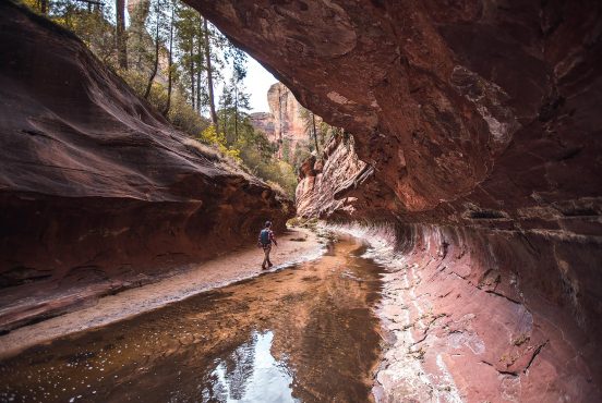
One of the biggest misconceptions about the first and longest segment of the PCT is that it’s a hot, flat, and unremarkable desert expanse. Spoiler alert: While heat is a factor in the desert, this 700-mile section of trail is a land of extremes, with bitterly cold nights, snow-capped peaks, and rolling green hills.
This easy section hike starts in the tiny mountain town of Mount Laguna and descends 7,000 feet over 35 miles, ending at Scissors Crossing along Route 78. Fragrant pine forest gives way to chaparral and manzanita-covered hills, offering dramatic views of the desert basin below flanked to the east by Anza-Borrego Desert State Park and the Cuyamaca Mountains in the west.
Dispersed camping is not allowed within the Laguna Mountain Recreation area. You’ll need to hike past Pioneer Picnic Area (~10 miles) to legally camp. If you plan to arrive the night before your hike, you can reserve a campsite at nearby Burnt Rancheria Campground or grab a room at the Laguna Mountain Lodge.
Trail town: Just 12 miles west of Scissors Crossing sits the charming town of Julian, California. During the Gold Rush, Julian thrived as a mining town, but today, it’s better known for its old-west charm and world-famous pie! After your hike, head to Julian to indulge in a slice of mouth-watering pie from Mom’s Pie House or if you’re in the mood for something savory, dig into a platter of BBQ paired with a craft brew from the Julian Beer Company.
The Sierra: Kearsarge Pass to Rae Lakes

Hike stats
- Length: 24 miles
- Type: Out-and-back
- Elevation gain/loss: +3967/-2581 ft.
- When to hike: Summer (July-September)
- Where to park: Onion Valley Trailhead
- Permit: A wilderness permit must be obtained from Inyo National Forest
The Sierra is defined by its glacial lakes, jagged mountains, cascading falls, and wildflower-covered meadows.
Starting from Onion Valley Trailhead, the trail climbs four miles past granite spires and shimmering alpine lakes before reaching the top of 11,700-foot Kearsarge Pass. From there, you’ll enter Kings Canyon National Park, where you’ll join the PCT and John Muir Trail, heading up and over Glen Pass before dipping into the Rae Lakes basin. Be mindful that snow can linger at higher elevations into mid-July and early August.
I kept this route short for two reasons. First, it involves climbing over two Sierra Nevada passes in a single day. Whatever your fitness level, the ascent can be exhausting and time-consuming. Remember, afternoon thunderstorms in the Sierra are common during the summer. If you see dark clouds on the horizon, hear thunder or spot lightning — get outta there.
Trail town: If you’re coming up from the south, you’ll need to pass through the town of Lone Pine to reach the trailhead. Despite not being as big and packed with amenities as Bishop, its more popular cousin to the north, Lone Pine is a cute trail town nestled in the Owens Valley. It’s even tucked up against the backdrop of Mount Whitney, the highest peak in the contiguous U.S.
This is a great place to carbo-load before your hike with a hearty breakfast at Alabama Hills Cafe. If you forgot something at home, Big Willie’s Gear Shop has you covered for all your backpacking essentials. Lone Pine is also known for the Alabama Hills, a cluster of rounded rock formations that have been used as a shooting location for a number of Hollywood movies over the years (including my personal favorite, Tremors).
Northern California: Castle Craggs to Gumboot Lake

Hike stats
- Length: 25.3 miles
- Type: Point-to-point
- Elevation gain: +6590/-2655 ft.
- When to hike: Fall (September-November)
- Where to park: Gumboot Trailhead / Soda Creek Trailhead
- Permit: None
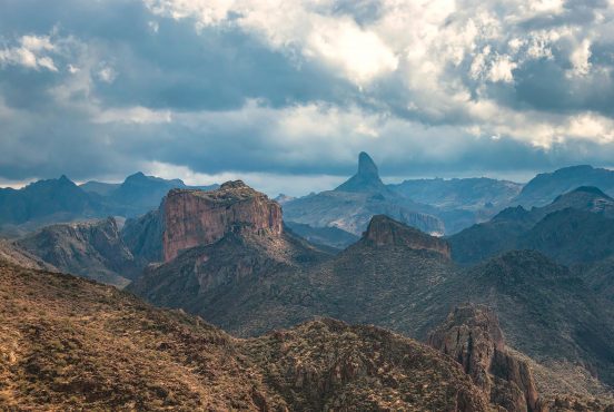
Northern California (or NorCal) gets a lot of flak from thru-hikers for its oppressive heat, exposed burn areas, and supposed lack of views. I beg to differ. Northern California is a place of wild and rugged beauty. It’s home to dozens of hikes around Mount Shasta, an active stratovolcano, and signals the end of the Sierra Nevada and the beginning of the Cascade Range.
This point-to-point route winds through the Castle Crags Wilderness, notable for the pronounced granite spires that rise up out of the surrounding forest. You begin with a strenuous climb up from Soda Creek Trailhead just off Interstate 5. As you gain altitude, Mount Shasta will gradually reveal itself in the distance along with expansive views of the adjacent Shasta-Trinity National Forest.
The mileage is admittedly aggressive but doable for experienced hikers. If you’re not hiking with a buddy, you can turn this into an out-and-back trip, stopping for the night at one of the most beautiful campsites on the PCT — about 18 miles in (PCT MM 1520).
Trail town: For thousands of years, Mount Shasta has been revered as a sacred site to the area’s Indigenous peoples. Visitors are drawn to the mountain’s purported healing vortexes, which are believed to emit strong spiritual energy. The town of Mount Shasta brims with artistic energy, featuring dozens of galleries, shops, and creative spaces.
Before you head home, take a stroll around town, admire some art, and grab a quick bite to eat from neighborhood favorite Yaks Shack.
Oregon: Elk Lake to McKenzie Pass

Hike stats
- Length: 31.7 mi.
- Type: Point-to-point
- Elevation gain: +5014/-4610 ft.
- When to hike: Summer (July-September)
- Where to park: Elk Lake Trailhead/McKenzie Pass
- Permit: Obtain a Central Cascades Wilderness permit for this hike.
Central Oregon’s unique geography has been shaped by a powerful combination of volcanic eruptions and glaciation. Ancient basalt fields, five active volcanoes, dense forests of hemlock and cedar, and small lakes blanket this region.
This section hike kicks off from the PCT connector trail at Elk Lake Resort. Continuing north from the PCT junction, you’ll be treated to awe-inspiring views of Three Sisters — a trio of volcanic peaks — and nearby Mount Bachelor. You can also take a side quest to Obsidian Falls, a large waterfall that plunges into a bed of shiny obsidian rock.
The trail then passes through a short burn area before reaching its end at McKenzie Pass. This hike is situated within the Three Sisters Wilderness, which requires the Central Cascades Wilderness Permit. Snagging permits for this hike can be hard to get. But if luck is on your side, you’re in for an unforgettable backpacking adventure!
Territory Supply writer and ultrarunner Emily Halnon holds the current FKT for the Oregon section of the PCT. Here’s the gear she used.
Trail town: A 30-minute drive east of McKenzie Pass leads to the delightful small town of Sisters, named in honor of the nearby Three Sisters mountains. Although most thru-hikers skip over Sisters in favor of Bend and its plethora of craft micro-breweries, I wouldn’t be so quick to write off Sisters.
With its old-western architecture, Sisters offers an authentic slice of Oregon with a heaping dollop of small-town charm. Satisfy your post-hike cravings at one of the town’s many breweries, cafes, and food trucks. And if you happen to visit in mid-June, check out the annual Sisters Rodeo!
Washington: White Pass to Goat Rocks Wilderness

Hike stats
- Length: 33.2 mi.
- Type: Out-and-back
- Elevation gain: +5722/-3115 ft.
- When to hike: Summer (July-August)
- Where to park: Clear Creek/White Pass Trailhead
- Permit: Wilderness permits are required. The self-issuing permits are free and are available at trailheads and Forest Service Ranger Stations.
The Goat Rocks Wilderness ranks as one of the most iconic stretches of the PCT. It gets its name from the rocky outcroppings and craggy peaks that look like the backs of goats.
The 30-mile section of the PCT that runs through the Wilderness features steep slopes and jagged peaks formed by ancient volcanic eruptions along with dramatic alpine meadows and frigid glacial lakes. This out-and-back hike starts at the White Pass Trailhead and steadily climbs above the treeline to the exposed Goat Rocks. Don’t forget to take a break to soak in views of Mount Adams to the south and Mount Rainier to the north.
If you’re not comfortable with heights, this hike may pose a challenge. It’s also not unusual for snow to linger on the trail well into the summer months. Check the latest conditions and trip reports from other hikers to see if you’ll need to bring extra gear for safe snow travel.
Trail town: Located near Mount Rainier National Park and a short drive from the PCT, Packwood is a year-round outdoor hub, catering to backpackers and national park goers in the summer, and skiers and snowboarders in the winter. After your trip, drop into Packwood Brewing Co. to unwind with a cold beer, tasty meal, and good company in their rustic taproom decked out with cozy blankets and a warm fireplace.
Find Your Next Adventure
Get epic travel ideas delivered to your inbox with Weekend Wanderer, our newsletter inspiring thousands of readers every week.